One hour Forecast TEC Map, Europe
Latest Data
Latest Data
Product Description
Product Description
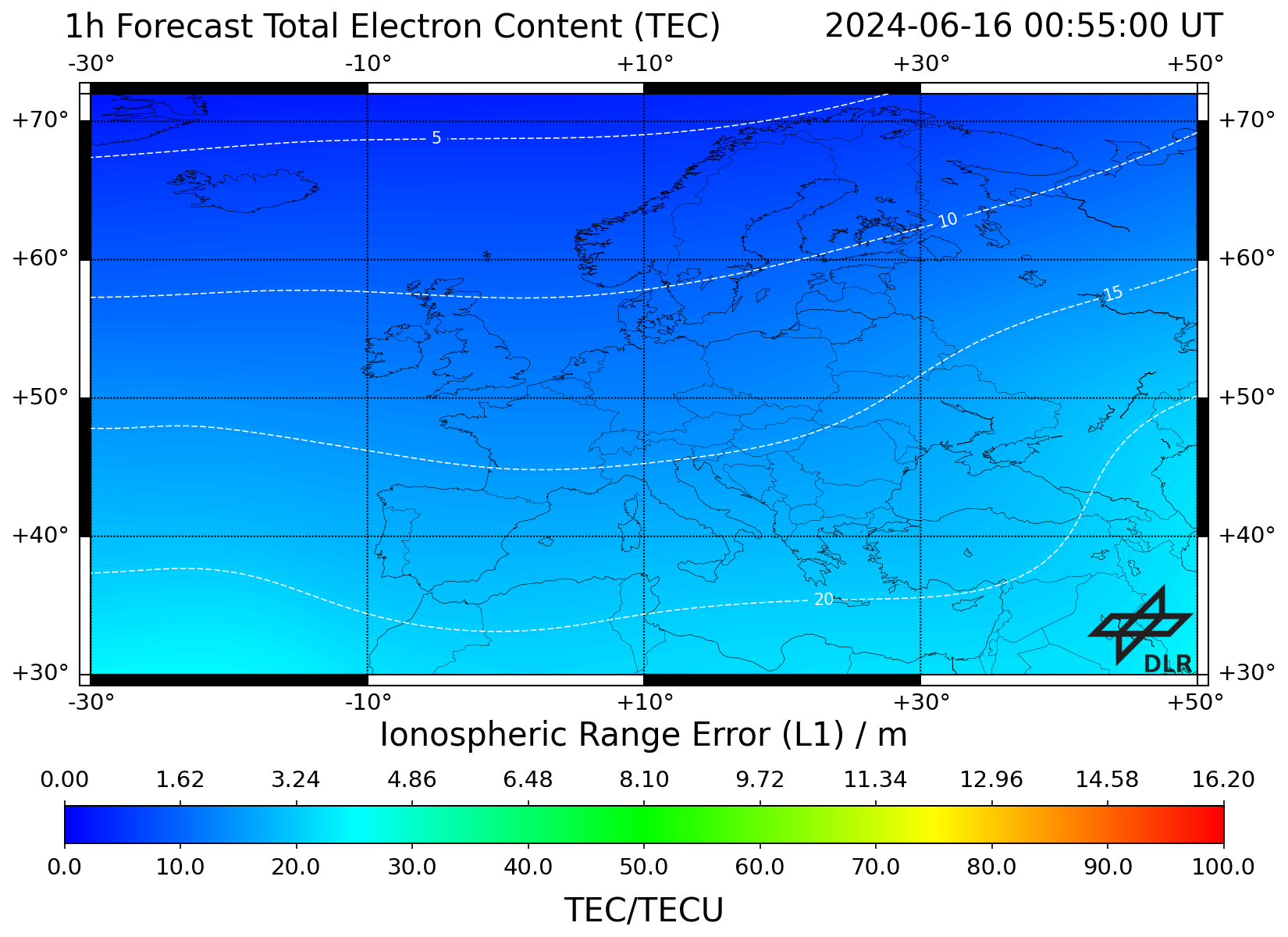
DLR's European total electron content (TEC) forecast maps provide information about an one-hour vertical TEC (VTEC) forecast at a shell-height of 400 km for the European region between 30°N - 72°N and 30°W - 50°E. The one-hour forecast is calculated as a sum of the actual European TEC map and a weighted sum of the temporal TEC gradient of the previous hour and the temporal gradient of the previous day at the same time. Consequently, the forecast maps are based on GPS data acquired from different providers in real-time via the German Federal Agency for Cartography and Geodesy in Frankfurt. The one-hour forecast is provided every 5 min as a VTEC matrix with an ionospheric grid point spacing of 1° latitude x 1° longitude in ASCII format. The error of the forecast is estimated as deviation between forecast and observation. A deviation map is computed after one hour, when the NRT TEC map is available. This deviation map is provided for the purpose of validation along with the product. More information is listed below.
Product Specification
| Specification | Description |
|---|---|
| External parties | German Federal Agency for Cartography and Geodesy, data providers below |
| Data providers | IGS, EUREF |
| Input data | GPS dual-frequency measurements |
| Input sampling rates | 1 s |
| Reliability of data source | Data is pre-processed by DLR including e.g. cycle slip detection |
| Region of sensors | Europe |
| Single layer shell height | 400 km |
| Spatial resolution | 1° Latitude x 1° Longitude |
| Boundaries of grid | 30°N - 72°N, 30°W - 50°E |
| Temporal resolution | 5 min |
| Time information | UTC Time |
| Timeliness | 5 min |
| Reference coordinate system | ECEF coordinate system with WGS84 reference ellipsoid |
| Algorithms | The one hour forecast is calculated as a sum of the actual European TEC map and a weighted sum of the temporal TEC gradient of the previous hour and the temporal gradient of the previous day at the same time. |
Quality Information
Quality Information
- Error of the Forecast TEC map for Europe provided one hour ago. It is derived from deviations to NRT TEC maps.

Archive
| Name | Last modified | Size | Description | |
|---|---|---|---|---|
| Parent Directory | - | |||
| 2023/ | 2024-05-15 01:58 | - | ||
| 2024/ | 2024-05-14 23:10 | - | ||
| latest/ | 2024-05-12 21:11 | - |
