TEC Gradient Ionosphere indeX (TEGIX)
The TEGIX measures spatial TEC gradients in the topside ionosphere (Swarm up to GNSS orbit) using GNSS Precise Orbit Determination (POD) measurements using Swarm onboard Langmuir probe (LP) measurements (using 2 Hz data).
Sample Data
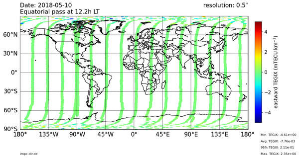
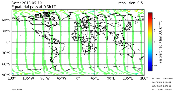
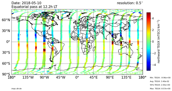
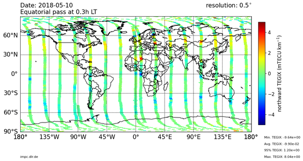
Global Swarm TEGIX
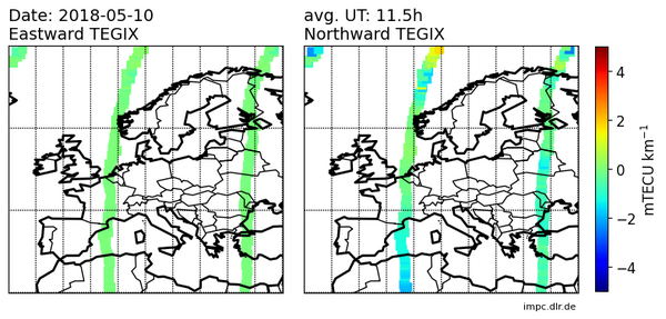
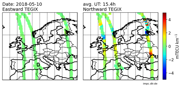
SWARM TEGIX for Europe
Product description
One data file in CDF format is produced per day since also daily Swarm TEC datafiles are used for the de-termination of TEGIX. The maximum length of the produced array corresponds to the resolution of the input data, meaning a maximum of 86400 measurements, or 1Hz sampling rate. However, the resolution of TEGIX will finally depend on the suggested combination of measurements. In the following, a description of the output variables is presented:
Variable name | Description | Type | Unit |
Timestamp | Time in Universal Time | CDF_EPOCH | ns |
Longitude Swarm | Averaged geocentric longitude of the Swarm satellites for all combined measurements for a certain epoch as described in section 4.2 | CDF_DOUBLE | deg |
Latitude Swarm | Averaged geocentric latitude of the Swarm satellites for all combined measurements for a certain epoch as described in section 4.2 | CDF_DOUBLE | deg |
Longitude IPPs | Averaged geocentric longitude of the central points CP for all combined measurements for a certain epoch as described in section 4.2 and Figure 4-5 | CDF_DOUBLE | deg |
Latitude IPPs | Averaged geocentric latitude of the central points CP for all combined measurements for a certain epoch as described in section 4.2 and Figure 4-5 | CDF_DOUBLE | deg |
TEGIX X | Value of TEGIX for the East-West component as defined in equation 34 | CDF_DOUBLE | mTECU km-1 |
TEGIX X P95 | 95-percentile value of TEGIX for the East-West component as mentioned in section 4.2 | CDF_DOUBLE | mTECU km-1 |
TEGIX Y | Value of TEGIX for the North-South compo-nent as defined in equation 35 | CDF_DOUBLE | mTECU km-1 |
TEGIX Y P95 | 95-percentile value of TEGIX for the North-South component as mentioned in section 4.2 | CDF_DOUBLE | mTECU km-1 |
Total TEGIX | Total value of TEGIX as defined in equation 33 | CDF_DOUBLE | mTECU km-1 |
N measurements | Number of GNSS measurements used to derive the TEGIX product at a given epoch | CDF_UINT4 | no unit |
Flags TEGIX | Flags characterizing the dispersion of TEC-gradient values within a given spatial resolu-tion that are used to compute the total vector | CDF_UINT4 |
Sample data can be found in the archive.