Juliusruh
Germany 54.6°N / 13.4°E ( Vertical Sounding Data supplied by IAP Kühlungsborn)
Latest Data


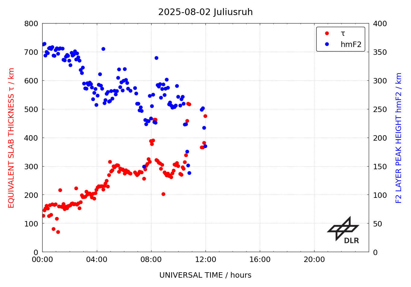
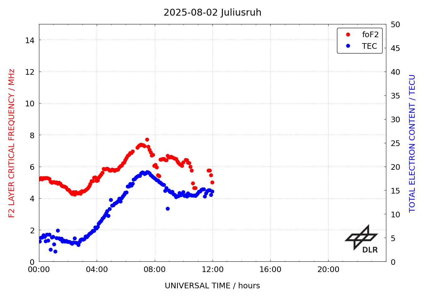
The equivalent slab thickness is a measure of the width of the shape of the vertical electron density profile of the ionosphere. The equivalent slab thickness is defined by the ratio of the total electron content (TEC) and the peak electron density NmF2 of the ionosphere’s F2 layer, cf. Jakowski et al. (2008) and Gerzen et al. (2013). The peak electron density is provided every 15 min from the Juliusruh (JR055) ionosonde stations in near real-time. At the coordinates of the ionosonde station, the slab thickness is computed by means of NmF2 and the corresponding VTEC derived from DLR’s global TEC maps.
The shape of the vertical electron density profile reflects the complexity of production, loss and transportation of plasma in the Earth’s ionosphere. A first order measure of the profile shape is the equivalent slab thickness. This ratio is very sensitive to the competition of plasma driving forces such as thermospheric winds and electric fields. Hence, this parameter is very helpful in exploring perturbation processes in the ionosphere.
URSI ID and coordinates of the ionosonde station used to calculate the equivalent slab thickness
| Station (URSI ID) | Location | Latitude/Longitude in degree | Operator |
|---|---|---|---|
| JR055 | Juliusruh/ Germany | 54.6°N / 13.4°E | Institute of Atmospheric Physics Kühlingsborn |
Product Specification
| Specification | Description |
|---|---|
| External parties | Operators of the ionosonde stations |
| Data providers | JR055 |
| Input data | Auto-scaled foF2/NmF2 measurements and global TEC maps |
| Input sampling rates | 15 min foF2 measurements and corresponding global TEC maps |
| Reliability of data source | The quality of the used global TEC maps is assessed by the corresponding TEC error map and the ionospheric F2 layer characteristics are obtained from auto-scaling algorithms like ARTIST. |
| Region of sensors | Europe |
| Spatial resolution | Computation of local slab thickness parameters at the location of the ionosonde stations |
| Temporal resolution | 15 min |
| Time information | UTC Time |
| Reference coordinate system | ECEF coordinate system with WGS84 reference ellipsoid |
| Algorithms | Slab thickness is defined as quotient of TEC and NmF2 |
| File format | ASCII |
| ASCII file format |
|
The equivalent slab thickness is based on the Global TEC map and Ionosonde data. The quality information of the Global TEC is available under the product menu.
