Disturbance Ionosphere IndeX Spatial Gradients (DIX-SG)
Latest Data
The ionosphere is the largest natural source of error for trans-ionospheric signals and existing geomagnetic or solar indices can only provide global and indirect information. Therefore, a temporally and spatially resolved ionospheric disturbance index is needed that objectively describes the current level of disturbance to the system and services for operators.
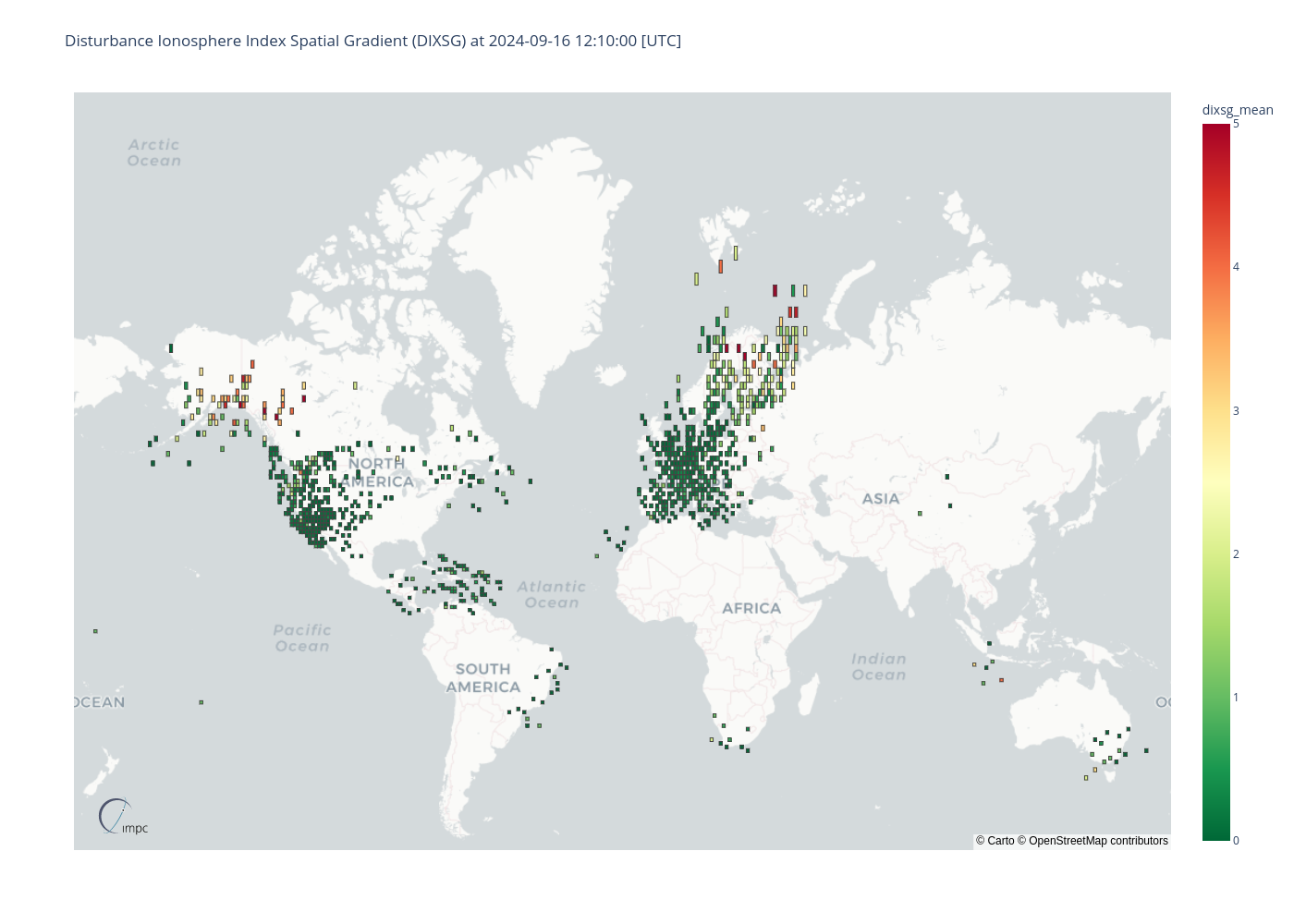
We have developed a prototype ionospheric disturbance index (DIX-SG) that is able to describe the ionospheric disturbance level with high spatial and temporal resolution. The index is based on measurements from 1Hz real time GNSS networks and provides a clear picture about global and regional ionospheric disturbances and their strength based on a simple but powerful numerical approach. As a real-time indicator that objectively and reliably describes the extent and strength of ionospheric disturbances, the DIX-SG could form an essential basis for future global space weather services.
The DIX-SG measurements are mapped into a regular grid (1°x1° lat/lon). Each grid cell presents the mean of the DIX-SG measurements located in this cell.
Product Specification
| External parties | German Federal Agency for Cartography and Geodesy |
| Data providers | IGS, EUREF, ASI, Greenland network of the Technical University of Denmark, UNAVCO |
| Input data | GPS dual-frequency measurements |
| Input sampling rates | 1s |
| Reliability of data source | Data is preprocessed by DLR including e.g. cycle slip detection |
| Region of sensors | Global |
| Single-layer shell height | 400 km |
| Spatial resolution | 1° x 1° latitude-longitude-bins |
| Boundaries of grid | global |
| Temporal resolution | 1 min |
| Time information | UTC Time |
| Reference coordinate system | ECEF coordinate system with WGS84 reference ellipsoid |
| Algorithms | The DIXSG algorithm is published: https://doi.org/10.1051/swsc/2018008 V. Wilken et al. (2018) An ionospheric index suitable for estimating the degree of ionospheric perturbations, J. Space Weather Space Clim. 8 A19 |
| File format | JSON: this file format includes metadata and data |

